
Tide and time
June 2, 2024, 8:20 am , by Richard Lutz
Heading north, from The Solway to The Clyde, the sea wrestles with southwest Scotland. It carves the shore, greets the shore, kisses the shore, fights the shore, retreats from the shore. RICHARD LUTZ walks the waterlines.
1.
The January wind sweeps the Solway. It’s all sand, marsh, sky and clouds. Shafts of light pierce the estuary’s rippled skin. Across the water are the hazy edges of Cumbrian ridges. The Solway separates Scotland from England.
The path, here on the Scottish side, wanders between a dried borderland of toughened grass and sand. There’s a corpse of a bird, desiccated, dead for a month. And another. And another. In a mile, we pass seventy five dead birds on the beach, eerily lined up as if their decomposing bodies were placed by design between wetlands and the shallows. Some of the birds had been half eaten. Some had withered away. Skeletal wings mark the upper beach. ’They’re barnacle geese’ says a friend. ‘Avian flu…’
It’s a lethal display of decomposition. We step over the remains, step around them, try to ignore them. By the time we reach Southerness Lighthouse, the long line of the dead has petered out.
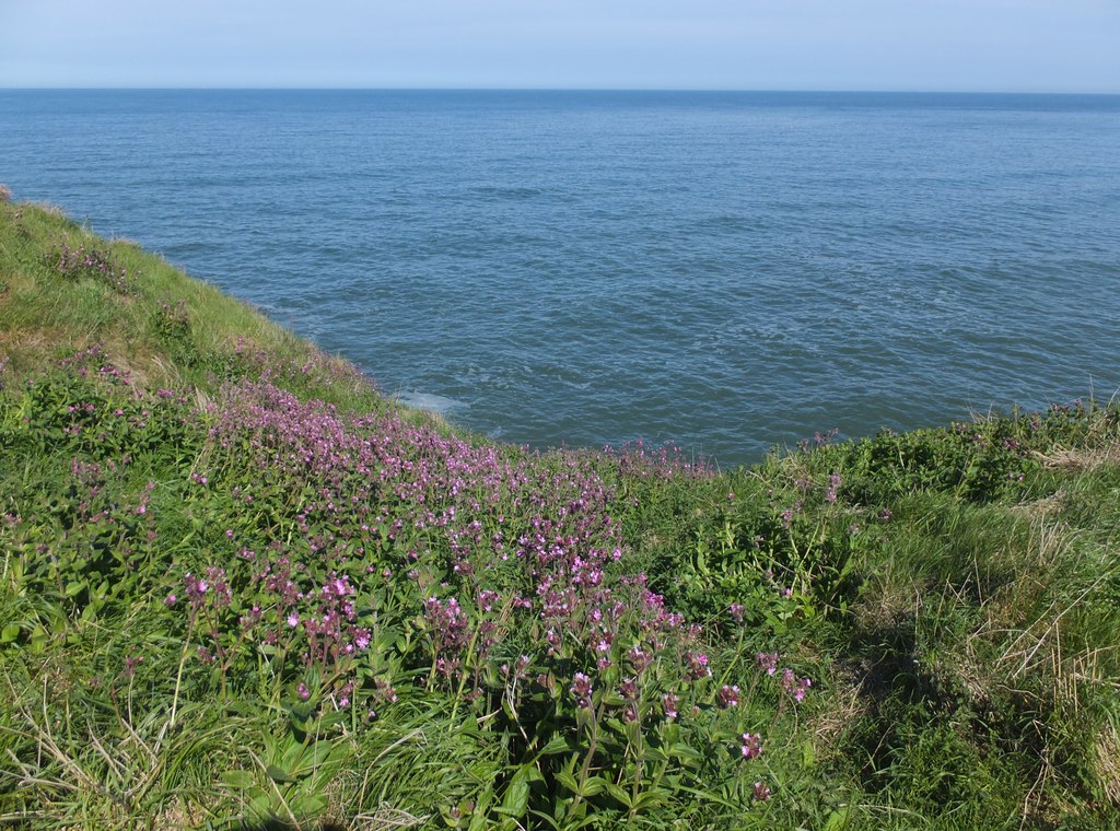
Just past the lighthouse, leaving the dead behind, we reach an arch on the shore.
Twin big slabs lean against each other. You enter from a cul de sac of sand and scrub trees, bend down through the tight archway and the estuary, the whole of the Solway, unfurls.There is a sound of curlews and oystercatchers searching for a late lunch and there’s a speckle of sun.
On a day, this day, a day littered with cloud, pulses of rain, death on the shore and, thankfully, the sudden burst of warm air.
2.
Tunafish Bay, north of Glen App, is a quiet nook. To the north, a coastal path runs 100 miles. To the south, ferries steam in and out of Loch Ryan linking Scotland and Ireland.
Actually there are no tuna in Tunafish Bay. I’m mistaken, I’m told… it’s actually Currarie Port. Always has been. But when I first stopped by this empty spot a decade ago, I devoured a pile of tunafish sandwiches. That’s how it got its name.
The sheltered inlet is a leisure centre for a dozen seals. They’re plunked on rocks, beached in autumnal sun or cruising the cove, heads popping up like periscopes, eyeing us eyeing them. My view from Currarie Port is the blue outline of Irish hills, the Rhinns of Galloway sticking out from the mainland like a hammerhead, the Corsewall Lighthouse that blinks at sea traffic.
Summer is over. Southwest winds bend trees and tough bushes. Berries dim in the fading warmth. Ferns and bracken turn brown and copper.
I approached Tunafish Bay by following the Shallochwreck Burn that bubbles west to the beach. A baleful bull blocked the way, threw a murderous glare and then decided that feeding off hardcore gorse was a better life choice than petrifying walkers ready to jump a fence quickly.
I leave the little bay via a steep path overlooking the riverbed of The Balloch Burn. Looking back south is a land of geometry: sloping hills, vertical rock walls, the horizontal line of ocean, the mass of blue sky, a lush green pasture where the Shallochwreck meets the Balloch.
The track out is steep and rocky. I round a hill inexplicably called ‘Donald Bowie’ and then follow a long stone wall.
Around the bend, tucked away in a swerve of the shore is the harbour of Ballantrae. Beyond is the long point of Bennane Head. The path follows the stoney dyke and the contours of the sloping headland. It’s rougher than it looks, tufts and tussocks make it a choppy walk. The angle of the grass makes my left leg continually lower than my right. It creates alot of awkward steps and the 9 mile walk seems to be longer than the last time I followed the path. As a matter of fact, each time I do this route, it lengthens. How can that be? Is the world stretching like an elastic band?
Below the cliffs, birds patrol the nooks and crannies. Fulmars fly past with stiff wings, using crevices for nesting. Oystercatchers screech. On lower rocks, cormorants stand as still as black statues. The headlands contain a series of tight slots, only big enough for a single skiff. They’re old quays to smuggle rum, brandy, tea, tobacco. Back in the days when nine miles was nine miles, stayed as nine miles.
3.
Pinbain stands 700 feet above the sea. And curving around it is a special route. It looks like two ruts in the green earth of upland Ayrshire.
The old road, still cambered in some sections, is the remains of an 18th century coach route that originally looped above Kennedy’s Pass. It’s believed to include the work of John McAdam who set about improving Scotland’s muddy lanes. In places, you can see the original small-stone convex surface below your boots if you stand above it.
Of course, Romans perfected the system 2000 years ago. But Britain lost the craft. Until McAdam showed up. Later, tar was added, ergo: tarmacadam or, simply, tarmac. Now the fruits of his efforts line the planet like veins on the back of your hand.
Today, the route is part of the walking path that snakes between the sea and the rolling hills. And roll they do. North of Pinbain’s bulk is Grey Hill followed by Fell Hill and Main Hill. This parade of rounded humpbacks tracks the sea’s blue mass.
Below Byne Hill, the most northerly top between Lendalfoot and Girvan, is the crumbling monument to a Napoleonic War hero known ominously as Black Bob. The eroding memorial looks down to the bones of a castle, a caravan park and out to sea; the soldier’s victories forgotten, the name a footnote. He’s the Ozymandias of the coast. Once terrible in anger, today reduced to stones and rubble. But the decay of his pillar still has uses. It’s a scratching post for horses, a fine picnic spot for families, a front row seat for audiences who monitor the western ocean.
4.
It’s a winter sea.
When the day rises, just after 8, the early sun over Maidens harbour hides behind low grey clouds that rub the horizon, then splashes to highlight patches of land across the Firth of Clyde, then hits off the Clyde to create water where’s there’s land and land where there’s water.
Arran and its sister islands of Cumbrae, Sanday, Bute and Little Cumbrae are afloat. They are unanchored from gravity in the cold air. So is the long curve of the North Ayrshire coast- as if painted by a Japanese artist. The world is lifted in slices of sun and cloud. Westwards on the Kintyre peninsula, Campbelltown melts into islets, the light changes and suddenly the port rejoins the hilly finger of mainland.
In the far distance, the sun touches the island of Jura. Next door is Islay. Closer in, the little jewel of Holy Isle appears, disappears, appears again. It’s just off Arran- a Buddhist retreat connected by a launch that sometimes picks up the curious. And sometimes doesn’t.
As the day disappears, the shell of the sky explodes. It’s pink, purple, crimson, almond.
This sea, this changing Clyde estuary, is always near. And sometimes it’s not light it offers. But rubbish.
I go to pluck junk off North Croy Beach. There’s a pocket where the shore curls into a crescent facing southwest and the tide and prevailing wind chuck marine garbage onto rocks and sea grass. You have to work hard to access this patch of hardscrabble stones- either by a steep switchback off upper fields or by hopping over a slippy outcrop.
Most rubbish on this beach is manmade plastic. Orange and blue pock the shoreline and, after a while, the eye picks out the washed up bottles, food wrappers, strands of net.
I fill bag after bag. A large sea-worn barrel is wrestled to the dump site. I grab a single sea boot. And rope, fish crates, cabling, planks of sodden wood and plastic bags choked with sand.
Out on the rumbly sea, there’s little traffic. No ferries, fishing boats, sailing yachts, speedboats. Birds abound: ducks, oystercatchers, cormorants and shags. A pair of cruising swans graze in the shallows. Pipets pop in and out of the seaweed. The wind whips in from the southwest past Maidens, Culzean, the sands of South Croy and that slippy outcrop called Isle Port.
5.
It’s been sitting, surveying, staring, observing, peering west for eighty years. And as you approach, you are compelled to stop. Over the decades, it’s been hollowed by wind and weather. But never forgotten. It stands as sentinel over the Scottish coastline.
It’s a quadrant tower, used to gauge accuracy of RAF bombing runs during World War II. Now, it’s a ghost, a concrete and brick skeleton. It’s not handsome. It’s almost an eyesore. But it is an integral part of the Carrick shore.
The tower stands on a tilted headland. There’s a sloping pasture on one side of the building and the wide wide sea on the other. Fifteen miles across the Firth of Clyde are the mountain crests of Arran. Rippling the southern horizon is County Antrim.
In this early spring, the headlands dipping to the sea are filled with red campion and bluebells. Haws line fences.
The quadrant tower isn’t as romantic as Dunure Castle three miles up the coast. And it’s not as easy on the eye as the symmetry of Culzean Castle two miles down the coast.
It’s more removed. There’s no car park. No signs, no crowds, no entry charges. You have to find it, get there, stumble across it, sit on its ruined steps, let the kids jump around it, stop and wonder what it was, why it peers over the sea, take in how quiet it all is, looking out- blindly now- west, always west.
Southwards, I find a small beach. I close my eyes and take a sightless sandy step, then two. And then two more. My imagination runs unleashed. I’m certain I’ll smack into a brick wall, step on shattered glass, a sharp rock or a scalder jellyfish. It never happens.
I raise my sightless distance to twenty and then fifty blind steps. It’s difficult because the natural response is to keep eyes open. Sight is our main sense, the force that lights the fuse. Other senses take over. I feel the constant breeze, hear the shushing of the sea, taste the sharp tang of salt, smell the wrack on the shoreline.
I know, walking without eyes, that out on the water a pair of swans patrol in the morning sun and a heron, still as a stone griffin, is waiting, waiting, waiting. Gulls and gannets swirl above.
I hear a shout, children always shout in happy freedom on a beach. I hear two dogs bark and chase. I hear sparrows and blackbirds in the high grass. I instinctively stretch my arms out wide to fend off danger, just like a small child. I wait to fall. I hear an engine run, a jet ski buzz on the water. I walk and wait to hurt myself. Then I open my eyes, I’m at wooden steps heading upwards.
6.
When the departed of Loch Lomond had to be buried properly, mourners used The Coffin Route over a hump of hills to consecrated ground near the Clyde. The ascending road is initially lined with mournful beech trees and then opens out to moorland and high fields.
This final procession headed for St Mahew’s chapel in the hamlet of Cardross that overlooks the brown lazy river that flows into the estuary. Here, the dead can rest.
Today, the sacred site, dating from the 1400’s, remains quiet, with its jumble of old gravestones. It’s the final stop for an untold number of people who were carried over the high country to be buried.
There were rules for transporting the dead, devised to stop spirits from plaguing the St Mahew mourners. The coffinbearers could not step off the path; the corpse’s feet must face away from home; the route had to have a crossroads; it had to travel over water (a small stream would do); and, most importantly, the coffin could never touch the ground until the burial ground.
The Coffin Route doesn’t carry the dead anymore. It carries hillwalkers, long distance trekkers, runners, strollers, dog owners, mad keen cyclists, the occasional quad bike or forestry four wheelers. Not a deceased body in sight as the path winds along the contours of Ben Bowie that separates the loch from the sea.
Lower down the slopes, late winter brings a minute hint of early daffodils. And above the coffin road are the skylarks.
They are everywhere. Or rather their songs are everywhere. I never can spot them myself as they rise vertically and then shoot down again. And then up again. They’re small birds, not anywhere as pretty as their song, and it takes a fine eye to catch them rising, falling and stalling mid air.
7.
The village of Barr is fed by streams with knarled names, the Water of Gregg, Laggan Burn, Lead Mine Burn and The Stinchar. It’s cupped by a ring of cold hills, part of the muscle of the Ayrshire back-country that keeps the sea at bay.
Above Barr, the rising sun stays low and burns through the row of beeches. The sky is decorated with half a moon, and the emerging morning spotlights a stand of larches. All is silence, winter light.
Above is a dome of cold blue. Below is whitened earth. There are no clouds, no mist, no rain.
The wind is freezing on the approach via the high hills. The road down is icy, twisty. It’s known locally as The Screws. East of Barr is a slip of a road that’s reduced to a thread of ice. It’s leads into The Forest of Changue, its trees as thick as hair on a dog’s back. Changue- it’s Gaelic for ‘the large hill shoulder of the impenetrable inner row of storm swept mountains.’
Ayrshire legend has it that centuries ago the Lord of Changue defeated Lucifer when, Bible in hand, the laird drew a circle round himself with the tip of his sword. So now there’s The Devil’s Footprint imprinted on a hillside and The Devil’s Trail, not to mention the steep climb to Fairy Knowe. Further in, there’s a remote waterfall ominously called The Linn of the Darkness.
Looming above the Forest of Changue is Haggis Hill, a name to prick the appetite of any Scot. Across the valley is the Nick of the Balloch, a taut high level route used by packhorse smugglers.
Today, Changue, Barr, The Screws, the trees, The Devil’s Footprint, Haggis Hill, they’re all snowbound.
Looking north off a small brow, confusion is imprinted on the horizon. There are too many rills, dips, rounded peaks, valleys. They don’t seem to match up to the OS map or digital guides. What is that knuckle of rock? Is that tiny farm Knockeen or Daljedburgh? Does that hint of road lead to Sally Pollack’s Bridge before winding up to the Nick of the Balloch?
Overhead, the sky is screened by an orographic cloud, created when air lifts off hillsides. Ridges appear and disappear. It’s an attractive and cold world, cracked with ice, covered with silent snow, capped with a frigid sky, framed by a mystery or two. It’s beyond Barr, beyond iced roads, beyond the touch, the smell, the sight, the taste, the sound of the sea.
share this post!


